Property Record
201 Kellwood Dr, Perry, GA 31069


NEARBY LISTINGS FOR SALE OR LEASE
Property Detail
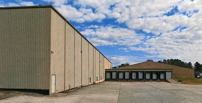
201 Kellwood Dr
Warner Robins, GA
Downtown P 20
0P0350012000
10.523 ACRES LL 275 13TH LD
Officebuilding
Houston
X
Georgia
13153C0153E
77
2024
10.52 AC
2024
Perry/Warner Robins
021300
Other Market Areas
85,998 SF
DEMOGRAPHICS near 201 Kellwood Dr
1 Mile
3 Mile
5 Mile
2024 Total Population
1,766
13,948
22,142
2029 Population
1,936
15,400
24,471
Pop Growth 2024-2029
+ 9.63%
+ 10.41%
+ 10.52%
Average Age
42
40
39
2024 Total Households
645
5,515
8,550
HH Growth 2024-2029
+ 9.46%
+ 10.24%
+ 10.34%
Median Household Inc
$13,474
$56,245
$67,078
Avg Household Size
2.50
2.40
2.50
2024 Avg HH Vehicles
2.00
2.00
2.00
Median Home Value
$96,542
$158,293
$175,471
Median Year Built
1975
1985
1991
Nearby Places
Map Layers
Map Styles
 Street
 Aerial
- Restaurants
- Banks
- Shops
- Fitness
- Groceries
SALE & LEASE HISTORY
LISTING DATE
SALE/LEASE

Jan 21, 2022
For Lease
Aug 08, 2018
For Lease
Nearby Properties
Address
Land Use
TOTAL SIZE
Lot Size
Zoning
Address
Land Use
TOTAL SIZE
Lot Size
Zoning
68,186 SF
562.30 AC
GU
Address
Land Use
TOTAL SIZE
Lot Size
Zoning
147,496 SF
66.05 AC
GU
Address
Land Use
TOTAL SIZE
Lot Size
Zoning
262,500 SF
20 AC
GU
Address
Land Use
TOTAL SIZE
Lot Size
Zoning
528,578 SF
32.75 AC
M2
Address
Land Use
TOTAL SIZE
Lot Size
Zoning
49,947 SF
4.03 AC
C2
Address
Land Use
TOTAL SIZE
Lot Size
Zoning
78,010 SF
20 AC
C2
Address
Land Use
TOTAL SIZE
Lot Size
Zoning
6,382 SF
24.71 AC
RM-2
Address
Land Use
TOTAL SIZE
Lot Size
Zoning
304,196 SF
177.46 AC
M1
Address
Land Use
TOTAL SIZE
Lot Size
Zoning
25,002 SF
15.17 AC
RM-2
Address
Land Use
TOTAL SIZE
Lot Size
Zoning
442.42 AC
M2
Address
Land Use
TOTAL SIZE
Lot Size
Zoning
151,525 SF
17.55 AC
C2
Address
Land Use
TOTAL SIZE
Lot Size
Zoning
19,810 SF
79.64 AC
GU
Address
Land Use
TOTAL SIZE
Lot Size
Zoning
19,125 SF
27.94 AC
R1
Address
Land Use
TOTAL SIZE
Lot Size
Zoning
31,248 SF
10.30 AC
RM-2
Address
Land Use
TOTAL SIZE
Lot Size
Zoning
255.39 AC
GU/M1
Address
Land Use
TOTAL SIZE
Lot Size
Zoning
4,820 SF
14.59 AC
RM-2
Address
Land Use
TOTAL SIZE
Lot Size
Zoning
12,000 SF
7.27 AC
RM-2
Address
Land Use
TOTAL SIZE
Lot Size
Zoning
226.03 AC
GU
Address
Land Use
TOTAL SIZE
Lot Size
Zoning
134,145 SF
3.08 AC
M2
Address
Land Use
TOTAL SIZE
Lot Size
Zoning
134,145 SF
3.08 AC
M2
Address
Land Use
TOTAL SIZE
Lot Size
Zoning
30,050 SF
47.52 AC
GU
Address
Land Use
TOTAL SIZE
Lot Size
Zoning
38,066 SF
11.73 AC
GU
Address
Land Use
TOTAL SIZE
Lot Size
Zoning
44,832 SF
11.95 AC
GU
Address
Land Use
TOTAL SIZE
Lot Size
Zoning
42,908 SF
7.93 AC
C2
Address
Land Use
TOTAL SIZE
Lot Size
Zoning
4,820 SF
14.95 AC
RM-2
Address
Land Use
TOTAL SIZE
Lot Size
Zoning
124.57 AC
M2
Address
Land Use
TOTAL SIZE
Lot Size
Zoning
6,948 SF
10 AC
C2
Address
Land Use
TOTAL SIZE
Lot Size
Zoning
33,970 SF
2.47 AC
C2
Address
Land Use
TOTAL SIZE
Lot Size
Zoning
13,888 SF
2.90 AC
C1
Address
Land Use
TOTAL SIZE
Lot Size
Zoning
35.91 AC
M2
The World's #1 Commercial Real Estate Marketplace
Connect with us
© 2025 CoStar Group
The information above has been obtained from sources believed reliable. While we do not doubt its accuracy we have not verified it and make no guarantee, warranty or representation about it. It is your responsibility to independently confirm its accuracy and completeness. Any projections, opinions, assumptions, or estimates used are for example only and do not represent the current or future performance of the property. The value of this transaction to you depends on tax and other factors which should be evaluated by your tax, financial, and legal advisors. You and your advisors should conduct a careful, independent investigation of the property to determine to your satisfaction the suitability of the property for your needs.